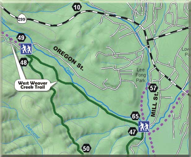
Approximate Length: 1.5 miles
Post numbers on map: 49 to 65
|

|
Highlights: Volunteer constructed new trail on BLM right of way, parking areas at both ends of the trail on Mill Street and Oregon Street, historic mining tailings.
 West Weaver Creek Trail West Weaver Creek Trail
|
The West Weaver Creek Trail supports the community's effort to complete a trail system that will be enjoyed not only by the local community, but also by tourists interested in hiking, running, biking, horseback riding and sightseeing in a close-to-town location. This particular trail segment is rich in historical and natural features and highlights the overall historic theme of Weaverville. It also links two major residential areas, providing an important alternative pedestrian route that bypasses Highway 299. There are parking areas at both ends of the trail, on Mill and Oregon Streets, just south of West Weaver Creek.
The West Weaver Creek Trail is located on public lands managed by the Bureau of Land Management. The BLM granted Trinity County a 50-year right-of-way for this trail in August 1999. This major milestone was critical, because most of the BLM lands near Weaverville were included in a proposed land trade. Without this 50-year right of way, public access to West Weaver Creek could have been denied by the new landowner. This right-of-way will now remain in existence if and when ownership changes.
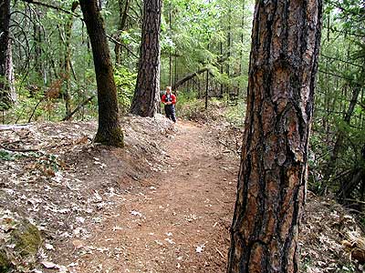
The vision that was put forth in the Weaverville Basin Trail Master Plan is for a trail on the south side of town that allows people to hike, bike or horseback ride all the way to the Industrial Park. This West Weaver Creek segment is an important first step in this effort. Trinity County, Trinity County RCD, and Trinity RC&D Council have all attempted to obtain funds from the California Department of Parks and Recreation's Recreational Trail Program (RTP) over the past three years to construct this trail, but the intense statewide competition for funds usually results in the money going to trails with much higher potential usage. The Bureau of Land Management encouraged the Trail Committee to find other ways to establish the trail so that we did not lose the easement. The opportunity to work with Trinity Occupational Training (TOT) and provide our dedicated Trail Volunteers with a project of this magnitude has resulted in a beautiful new section of trail for members of the
community and visitors alike. This project took place under the supervision of Trail Volunteer, Jim Love, who has devoted a significant number of hours in the layout and construction of this trail. As one new user of this trail told Jim, "This is like a fairy tale trail!"
|
|
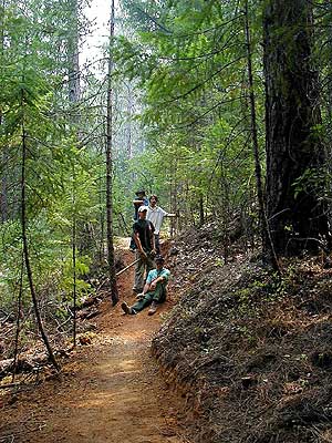 TOT Crew on Trail TOT Crew on Trail
|
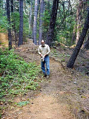 Jim Love, Trail Volunteer Jim Love, Trail Volunteer
|
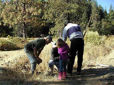
Trail Volunteers Installing Sign
|
 Lots of evidence of historic mining tailings Lots of evidence of historic mining tailings
|
This trail offers some of the highest potential for historical interpretation, as it is replete with historical placer mining sites. Prior to the trail right-of-way granting from Bureau of Land Management to the County of Trinity, these sites were well documented by KEA Consulting and BLM Archeologist. Introduction to placer mining concepts could be made at the Jake Jackson Museum and Historical Park. Visitors to the historical park could then be directed down the Lee Fong Trail and up the West Weaver Creek Trail to mining sites for further exploration and historical interpretation of hydraulic mining.
|
Return to the Weaver Basin Trail Home Page
|