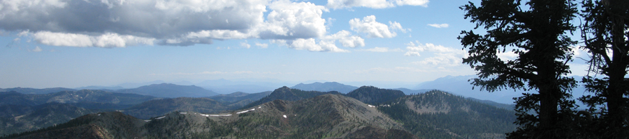


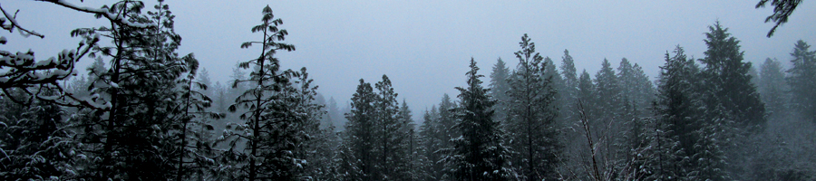
Weaver Basin Trail System


Trinity Trail Alliance Home Page
Weaver Basin Trail System Web Map Application
For access to the new WBTS Web Map on your mobile device for use on or off the trails, please follow these directions:
- Go to Google Play (Android) or the App Store (Apple)
- Search for ‘ArcGIS Field Maps’ (a free application)
- Install the ArcGIS Field Maps app (logging into an existing app store account may be required)
- Open the the app, choose "Continue without signing in" and search for ‘Weaver Basin Trail System’
- Select the Weaver Basin Trail System map
- Explore the WBTS!
Have fun out on the trails!
2023 Weaver Basin Trail System Map ~ Poster size 36x36 (29 Mb PDF)
Archived Weaverville Basin Trail System Guide (2005)
TRAIL USER DESCRIPTION FORMS
Download the bundled Weaver Basin Trail System segment forms (1 Mb Zip File). Once you have completed your forms please send them as an attachment to This email address is being protected from spambots. You need JavaScript enabled to view it. or drop them off at the TCRCD Office. If you have any questions, please call us at (530) 623-6004.
THE RCD'S ROLE
In the fall of 1996, the RCD was requested by the Weaverville Basin Trail Committee Chairman, Scott Morris, to be the lead agency to help the Trail Committee fulfill its goal of a basin wide trail system. The RCD has agreed to adopt this community development project and to facilitate funding and trail maintenance needs. This volunteer Committee has been working for more than ten years to designate approximately 40 miles of trail, complete Environmental Assessment with the Forest Service and include the preliminary trail system map in the Trinity County General Plan. The Weaverville Community Plan has been amended to accurately reflect the trail system and to protect it as development progresses in the basin.
The RCD is in support of the effort to complete a trail system that could be enjoyed not only by the local community, but also by tourists interested in hiking, biking, horseback riding and sightseeing. This trail system will provide tourists with a sense of wilderness adventure with close proximity to a hot shower, a good meal and comfortable accommodations at the end of the day. This in turn, will provide much needed revenue to the community which has been hard hit by changes in the timber-based economy. The Weaverville Basin Trail is unique because of the many opportunities that exist for historical and natural feature.
One of the efforts made by the Trail Committee is to educate the local OHV users about the sections of trail that are off-limits to motorized vehicles. In a letter to the editor of the Trinity Journal, the Committee pointed out that in order to obtain access on private lands within the system, landowner permission was granted in many cases only if motorized use was not to occur. There still exist many locations in the Basin for OHV use, but in order to keep rights to the trail for the majority of users near town, it is critical that the trail designations be followed.
Weaverville Basin Trail System Master Plan (9MB pdf)
Trinity Lake Trail |
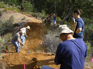
Trail Work Volunteers
THE COMMITTEE MISSION STATMENT
The mission of the Weaverville Basin Trail System is to develop a comprehensive trail system for hikers, mountain bikers, horse riders for Weaverville residents and tourists. This system will foster an appreciation for the natural surroundings, plants and wildlife of the area as well as enhancing the economy of the community through increased tourism. Through maintenance of a trail network around Weaverville the many historical features of the area will be preserved and interpreted along with ensuring public access in a developing town. The Weaverville Basin Trail System will serve the community with cultural, educational and recreational opportunities.
TRAIL SYSTEM HISTORY
The Weaverville Basin Trail Project began in 1986 with the completion of the Weaverville Community Plan, a document adopted by the County of Trinity to guide the future development of Weaverville, a historic gold rush town nestled in the mountains of north-west California.
The Weaverville Basin Trail Committee was formed in 1988 to develop a plan to preserve Weaverville's trails. This committee is made up of representatives from various trail user groups, the U.S. Forest Service, BLM, Trinity County Historical Society, County of Trinity, Weaverville/Douglas City Parks and Recreation District, groups such as the Mountain Bike Club, the Running Club and Trinity Riders, as well as interested citizens at large.
Since its inception the project has grown in scope and size. The system will eventually circumnavigate Weaverville with over 50 miles of trail through biologically diverse terrain, offering many opportunities to interpret historic mining sites, riparian zones, wetlands, old growth forests and timber harvest sites.
The project has formed alliances between private property owners, county, state and federal agencies through trust, understanding and the hard work of a motivated and sensitive ad hoc trail committee. The Weaverville Basin Trail System is a terrific example of what can be accomplished when government, private landowners and interested citizens join together to make something positive happen in their community.
"The Weaverville Basin Trail System: A Trail Through Time..." historical brochure and trail map is available at many local stores and the Chamber of Commerce in Weaverville.
For more information please contact us:
This email address is being protected from spambots. You need JavaScript enabled to view it.
Trinity County R.C.D.
P. O. Box 1450
Weaverville, CA 96093
(530) 623-6004
