 |
| Spring 2008 |
Vol. XVII, No. 2
|
|
INFORMATION TECHNOLOGIES
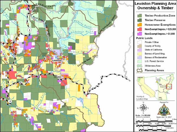
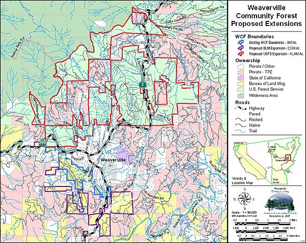
In 2007, the District GIS work involved a wide variety of projects including updating Trinity County’s General Plan, supporting Watershed Restoration throughout the county, technical assistance to the Natural Resources Conservation Service, and planning for the expansion of the Weaverville Community Forest Stewardship project. Another GIS-specific grant that was approved in 2007 is to update the spatial data layer for the Trinity County Resource Advisory Committee (RAC) that integrates features from numerous organizations representing all the RAC funded projects in Trinity County for 2007.
|
Trinity County General Plan
|
|
|
In assisting the Trinity County Planning Department with the preparation of its General Plan Update, many varied GIS tasks were completed during the course of the project such as; creating Planning Area boundaries loosely based on the watersheds containing each of the major community populations, updating the county-wide parcel layer and private ownership database, extensive research and collection of natural resource and administrative spatial data, detailed analysis and data display, and hardcopy and electronic map layout.
|
Weaverville Community Forest
|
|
GIS support was critical in the planning process of expanding the existing 984 acres of Weaverville Community Forest (Bureau of Land Management Lands) to include approximately 12,000 acres of US Forest Service lands that have been approved by the USFS Regional Forester as a Stewardship Area for inclusion in the WCF.
|
|
Return to the Trinity County RCD Home Page
|