South Fork Trinity River Watershed Restoration Gains Momentum
 |
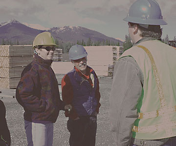
Efforts to reduce the impacts that the extensive network of roads in the South Fork Trinity River watershed has on the river and its fisheries have come a long ways in the last few years. It has taken the coordination of landowners and land managers with the agencies funding restoration to develop the long-range plans needed to make this happen.
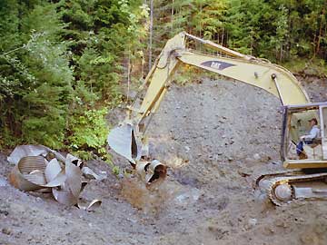
The District began road-related watershed restoration in the South Fork of the Trinity River on private lands in 1997. That early work was exclusively road upgrades – keeping the roads in place, but making them less prone to washouts or catastrophic failures. In 1998, with the cooperation of the USFS in Hayfork, work began on public lands. The Forest Service completed comprehensive plans in a number of areas that looked at access for future forest management and fire fighting, recreation and impacts to the natural environment. These final plans include decommissioning and hydro-closing some roads. The USFS completed another assessment after the Sims Fire in 2004. Work identified in this analysis primarily involves fire rehabilitation, including a small portion of the Hyampom Compartment. On-the-ground work in this area began last summer, and is expected to be completed by early this summer. Geographically speaking, these areas represent all of the SFTR upstream of Grouse Creek.
All road-related restoration projects, whether upgrade, hydroclosure or decommission are designed to help the Forest Service meet the South Fork Total Maximum Daily Load established by EPA in 1998 to reduce sediment getting into the river while maintaining a road system that provides access for resource management and recreation. Considerations used in developing the road assessments include risk of harming stream habitats related to road location and design, reducing annual road maintenance costs, and current and future transportation needs.
From 1997 through 2005, the District, in cooperation with the USFS, has completed 147 miles of road upgrades, 6 miles of hydroclosure and 28 miles of road decommissioning in the South Fork of the Trinity River. The District has received funding from a variety of sources over the years, such as the Trinity County Resource Advisory Committee, U.S. Environmental Protection Agency, California State Water Resources Control Board, U.S.F.S. and the California Department of Fish and Game, and has received tentative approval for funding from the California State Parks OHV Commission. We gratefully thank all of them for their continued support.
|